Sorry it took a bit to get pics up...spent only a few hours at his house. We just explored a bit.
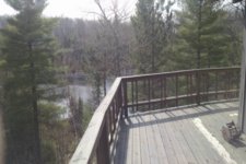
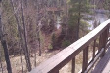
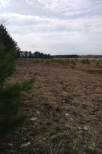
The first couple pics were taken from his 2nd level deck. That's the pond/small lake in front of his house.
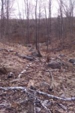
The right side of the pic is where the backside of the hill behind the bldg led. We didn't venture down there. Not enough time.
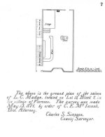
He found out that the bldg was actually on his property. West of his house (on the small pond on the map above) against the treeline. It's the rectangular brown shape in the photos.
There's actually a wide gravel lane/road that goes from the main road to the treeline. Right next to where the bldg was.
The road continues past the bldg area another 50yds or so into the woods. The ground starts sloping up to a small crest and then a pretty steep hill to the edge of the lake.
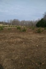
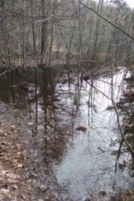
The "swampy" area isn't reall that swampy. It's more like flooded grass and mud.
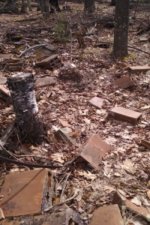
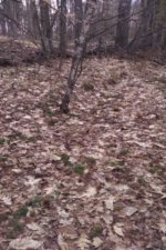
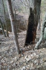
The black piece of tree bark had been stuck into the ground right there.
No other burned out trunks, trees or anything right there. Looks like someone took half of the bark off of a tree and jammed it into the ground. No roots etc...
The earth around that small cluster of trees and the bark piece was very soft and I ended up shoulder deep under the trees in very easily.
The bark piece was just on the backside of the small hill behind where the bldg was.
It leads down to the water to a small point. Kind of a lagoon to the right and the left looks like a flooded backwater that has very thick tree stands in there.
There was a huge log that someone had put there to cross. 20-30' long and 1-2' diameter.
The bark was worn off on the top of it where you'd walk. There are no trees in that area that are that large and there was no stump. It was deliberately put there.
We didn't walk down the washout at all. Just explored around the edge of it.
In the couple of pics of it, you can see on the left where rocks had been arranged in a small semi-circle.
It's only 20' down the slope on the left hand side. There was a small pit in front of it with early tires/wheels. Wooden spoked wheels, narrow tires.
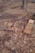
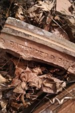
The brick that you see was 30 yards into the woods SE from the bldg. So between the bldg and the washout. There were 2 areas where the bricks/blocks had been arranged in a 10' across circle. Some of the block was curved, other pieces straight. No discerning marks other than Patented.
We're going to bring the detector out and detect the center of the rings and bring some shovels!!
The area just behind these rings had quite a few rows of barbed wire fencing that went from the edge of the washout, behind the block rings and then ran parallel to the back of the bldg area. Most of it down and half buried.
The woodline where you see the ground change from browned out to grassy with a large hump has a worn footpath with 2 rows of barbed wire fencing that runs parallel to the where the bldg was.
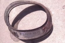
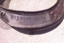
The metal ring is an apron from a pot belly stove from a company out east that was pretty popular. (I forget the name).
I caught a glimpse of it in the dirt between the barbed wire and the block area and had to dig to pull it up. There are more pieces buried there but I ran out of time.
Actually, it was buried under a row of barbed wire.
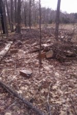
The pic with the small tree in the center was supposed to show one of the fence rows to the left of it. You can make out the little earth bank.
The exciting part about the small rise and then slope behind that leads down to the lagoon/swamp/flooded area was talked about in a few accounts that Jim, my friend, had read. Said there's a small hill behind the bldg that runs down to the water.
The burned out hunk of bark was so out of place. Going to MD the road/driveway from the edge of the woods to the water the next time I'm out there.
You can see the lane/road coming in and breaking off to the house on the left and to the right. The rectangular area is in the middle of the map.
https://goo.gl/maps/6Wvth
k..the pics.