
- Joined
- Jan 11, 2006
- Messages
- 3,708
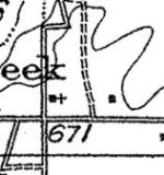
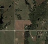
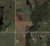
If everything works out with the permissions, I hope to be detecting a spot where an old church used to be. The B&W map is from 1912. The color aerial is the site today. I've driven out there and I can find no evidence of a foundation or location. Wish me luck!
")
