bugman
Senior Member
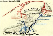
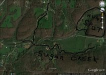
Need some help from you civil war relic hunters.I have permission to hunt this spot. the first map is a battle map of pea ridge and you can see the union was camped along sugar creek before the battle and advanced about 2 miles to the present day battlefield. the second map is a google earth map of my area, but its hard to tell if the troops were streached out that far. any ideas would be helpful. from the telegraph road to my spot is about .5 mile